Transform stores and spaces into high‑impact communication channels with end‑to‑end digital signage. Spanning strategy, hardware provisioning, a locally hosted digital signage platform, installation services and support, our digital signage solutions are built for enterprise governance and long‑term performance.
Enterprise Digital Signage. Designed to Scale. Delivered End-to-End

The Challenge - and How We Solve It
Updating content across dozens or hundreds of locations manually is slow, inconsistent and operationally expensive.
Engagis centralises control through Impress Plus — launch campaigns across every store in minutes, maintain brand consistency at scale and reduce the operational effort through automation.

Most digital signage projects involve multiple vendors with no single owner. When something breaks, accountability disappears.
One partner. One contract. Full accountability from strategy through to ongoing managed services — so you always know who to call.
Screens that go dark cost revenue and damage brand perception. Reactive support isn't good enough at enterprise scale.
Proactive monitoring, 99% uptime SLA and rapid incident response means most issues are caught and resolved before your store team even notices.
Australia's Most Trusted Digital Signage Provider
With over two decades of experience, we deliver reliable, scalable digital signage solutions trusted by leading brands across Australia and beyond.
24+ Years Delivering Enterprise Digital Signage

10,000+ Locations Across Australasia
80,000+ Connected Devices
99% Uptime Across our Networks
Telstra Future Retail Environment (FRE) 2.0
A glimpse of how we've collaborated with Telstra on their newest store design.
One Partner. Complete Delivery. Enterprise Accountability.
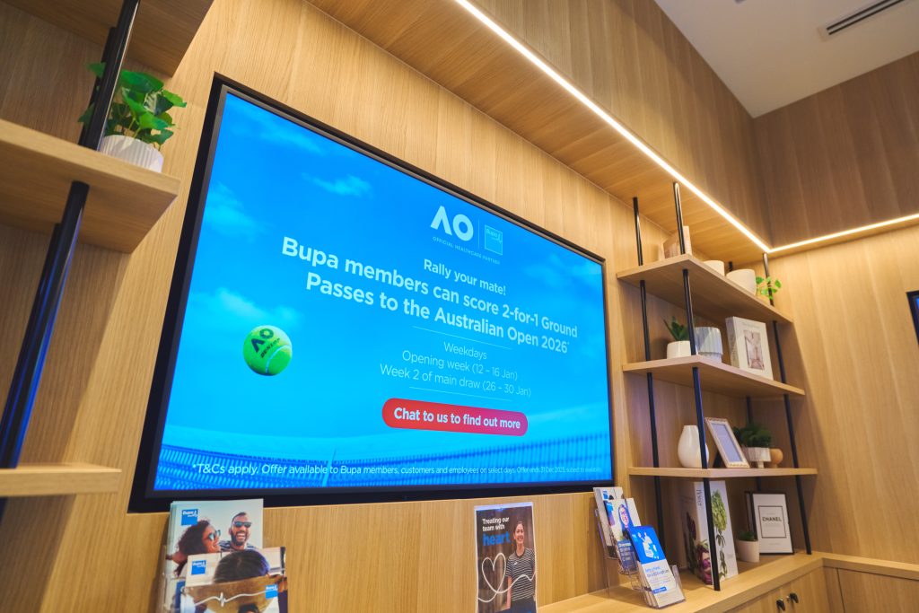
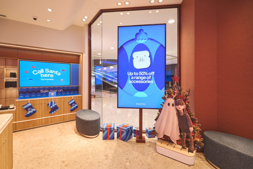
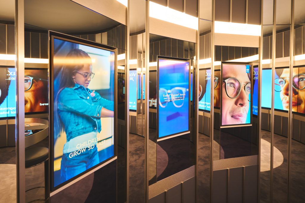
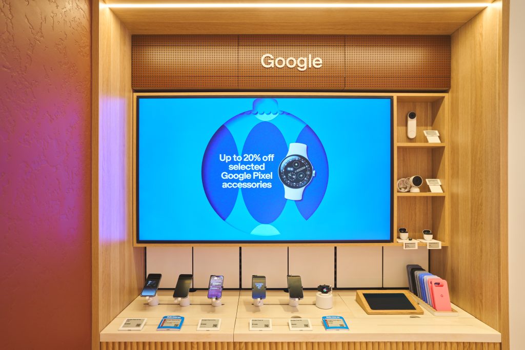
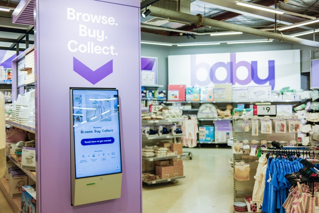
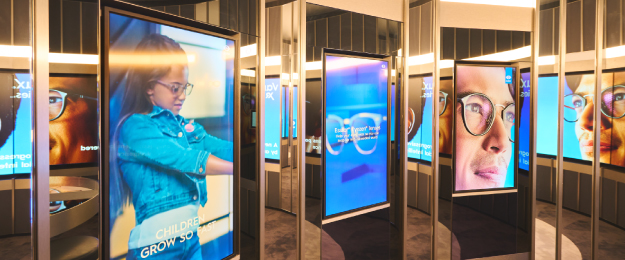
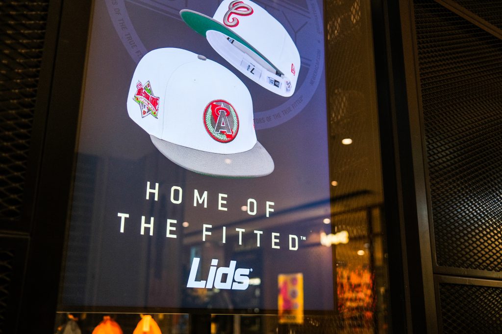
Digital Signage in Real Retail Environments
See how our digital signage solutions come to life in real retail environments, enhancing customer experiences and driving engagement at every touchpoint.


Display Technologies for Every Scenario
We help you select the right display for each environment, balancing visual impact, performance and long‑term operational fit.
LCD Displays
Commercial grade LCD displays for clear, reliable messaging across retail and workplace environments.

LED Signage
High impact LED displays for large format visuals, feature areas and high visibility retail spaces.
Transparent LED Signage
Dynamic digital content integrated into windows and glass without blocking visibility or natural light.

E-Paper & Digital Shelf Labels
Low power e-paper displays available in a range of sizes, supporting digital shelf label and larger format applications.

Media Players
Support for both external media players and system on chip displays, selected to suit performance, content and operational requirements.

Touch Screens & Kiosks
Interactive displays that support product discovery, assisted selling and customer self service experiences.
Trusted by Leading Retailers and Enterprise Organisations


Designed for Every Enterprise Stakeholder
Marketing, Experience & Performance
Create stores and spaces that look better, feel consistent and perform stronger. Effective digital signage supports visual merchandising, brand storytelling and in-store communication, helping teams deliver high quality experiences across every location.
Highlights:
- Consistent execution of visual and brand standards.
- Rapid deployment for promotions, campaigns and store storytelling.
- Precision targeting and localisation without compromising brand control.
- Improved customer experience across physical environments.
IT, Security & Operational Support
Keep your digital signage network secure, available and performing at scale. Engagis provides enterprise grade governance, monitoring and support to ensure screens remain online, content plays as intended and issues are resolved quickly across distributed environments.
Highlights:
- Proactive monitoring and incident response.
- High availability and uptime focused operations, with 99% uptime across our networks.
- Clear escalation paths and single vendor accountability.
- Secure access, permissions and governance controls.
- ISO 27001 Certified for Information Security.
Retail Operations & Delivery
Deploy, transition and operate digital signage across your network with minimal disruption to stores and spaces. Engagis manages rollout, migration and ongoing operation as a single service, keeping screens reliable, consistent and easy to manage as your stores grow.
Highlights:
- End-to-end deployment, rollout and migration support.
- Minimal impact on store teams during rollout.
- Single accountable partner across the full lifecycle.
- Ongoing managed service and operational oversight.
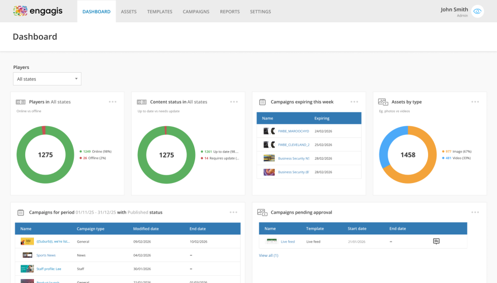
Ready for Impress Plus?
An enterprise‑grade, Australian‑hosted digital signage CMS designed for large, multi‑site organisations. It combines scale, security and creativity, empowering teams to deliver meaningful, data‑driven experiences across every screen.
Key Benefits of Impress Plus
- Effortless Campaign Management
- Enterprise Security & Compliance
- Advanced Reporting & Insights
- Precision Targeting & Localisation
- Seamless Integrations & APIs

Why Enterprise Teams Choose Engagis?
Built for scale, security, and reliability – trusted by enterprise teams across Australia.
- Proven at enterprise scale for over 24 Years.
- ISO 27001 Certified for Information Security.
- Australian‑owned and hosted platform.
- Designed for 99% uptime.
Tailored for Enterprise Environments
Transforming physical spaces with industry-specific digital experiences that engage, inform and perform.
- Retail & Fashion Retail.
- Workplace & Corporate.
- Banking & Financial Services.
- Telco and Service Based Retail.
- Pharmacy & Healthcare Retail.
- Automotive.

Commercial Models and Value Creation
Digital Signage as a Service
Engagis offers Digital Signage as a Service (DSaaS), providing a flexible, service-led model that combines hardware, software, deployment and ongoing support into a predictable monthly cost.
Retail Media Monetisation
Engagis enables retailers to monetise digital signage by supporting the controlled delivery, measurement and reporting of supplier and third-party campaigns across physical environments, while maintaining brand, inventory and content control.
Case Studies

Your Digital Signage & AV Starts Here
Get expert guidance, reliable delivery, and ongoing support - end to end. Talk to our team about solutions tailored to your organisation.